I built Mellow Bike Map in collaboration with Bea Malsky and Kalil Smith-Nuevelle as an attempt to improve on Google Maps' biking directions. The basic premise of Mellow Bike Map is that biking on side streets is safer and more comfortable than biking on commercial arteries, whether or not they have bike lanes.
Bike lanes on big streets are prioritized in a number of different ways. Google Maps weights them heavily in its bike directions, for example, and bikeability indexes like the Bike Score often consider mileage of bike lanes to be a proxy for bike safety. However, in the absence of full protection via concrete barriers, bike lanes on commercial arteries encourage cyclists to share crowded roads with loud, dirty, high-speed traffic.
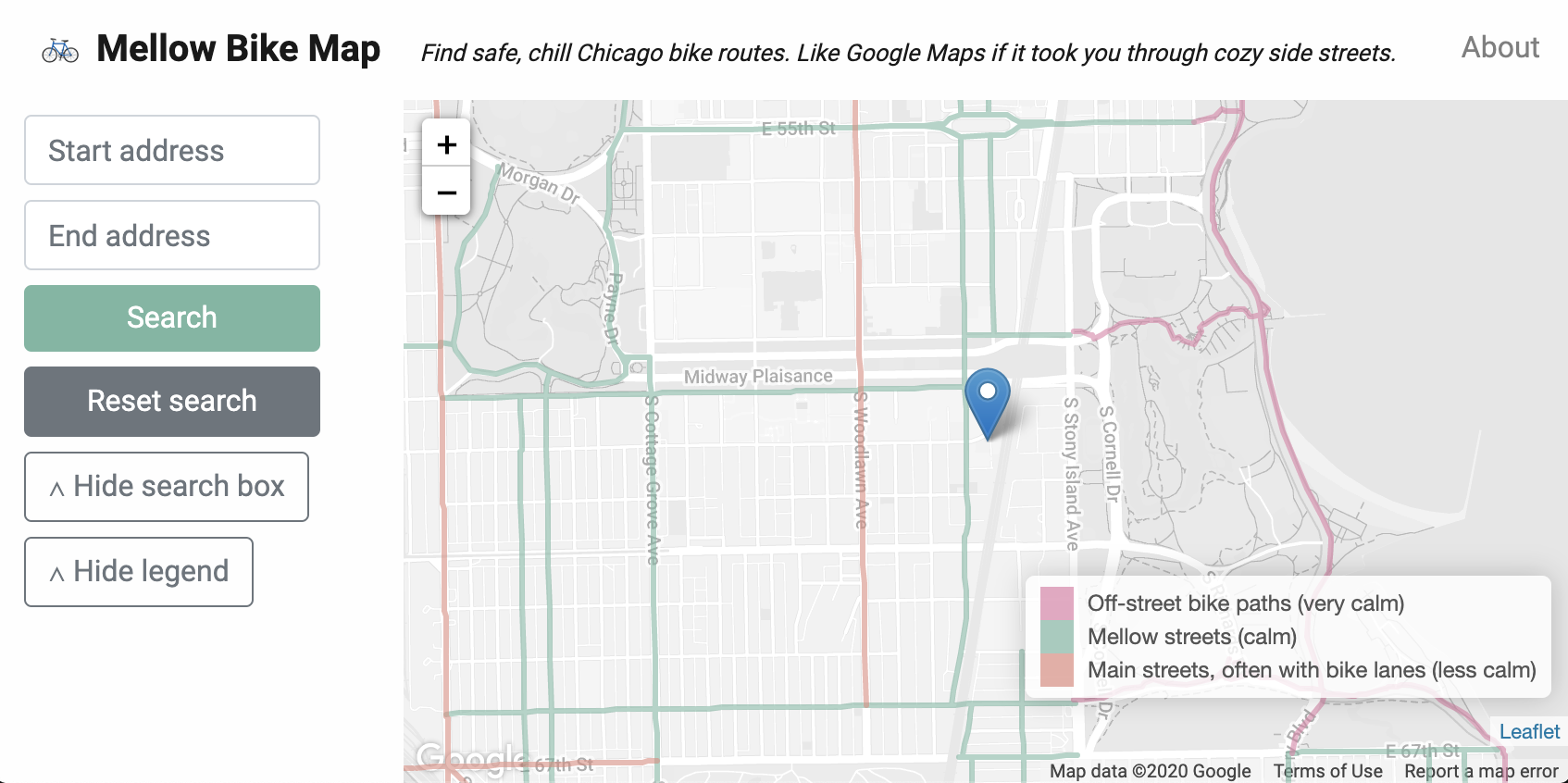
Based on the Chicago Reader's Mellow Chicago Bike Map, Mellow Bike Map instead emphasizes a different kind of street as the ideal bike route: side streets that are low-speed, infrequently used, and that feature traffic calming infrastructure like speed bumps and roundabouts.
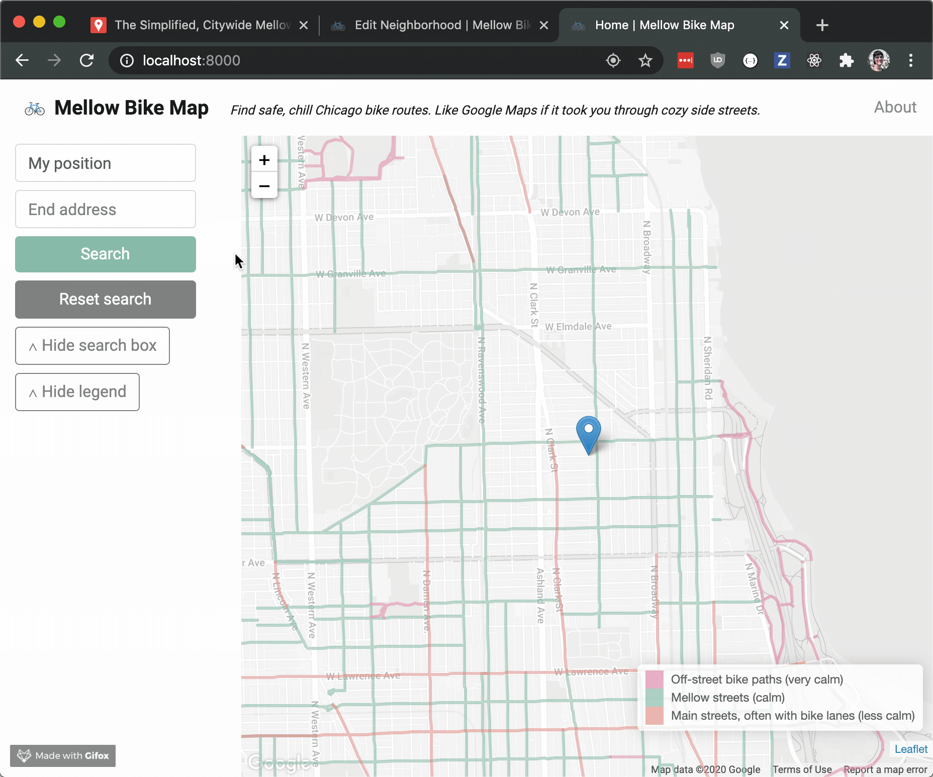
You can start a route from your current position if you grant the app location access, or you can manually search for start and end addresses. The app will prioritize off-street bike paths, then mellow side streets, then main streets with bike lanes, and then everything else.
The directions engine uses pgRouting on top of map data from Open Street Map which we transformed into a routing graph using osm2pgrouting. Building on top of pgRouting gave us a great routing algorithm out of the box but it meant that we had to build an interface to manually tag every mellow OSM way, since the Reader's Mellow Chicago Bike Map is just a collection of hand-drawn polygons and can't be automatically tied to OSM ways. Luckily, Bea and I had previously collaborated on django-geomultiplechoice, which we were able to use to quickly build a simple interface to manually tag mellow ways.
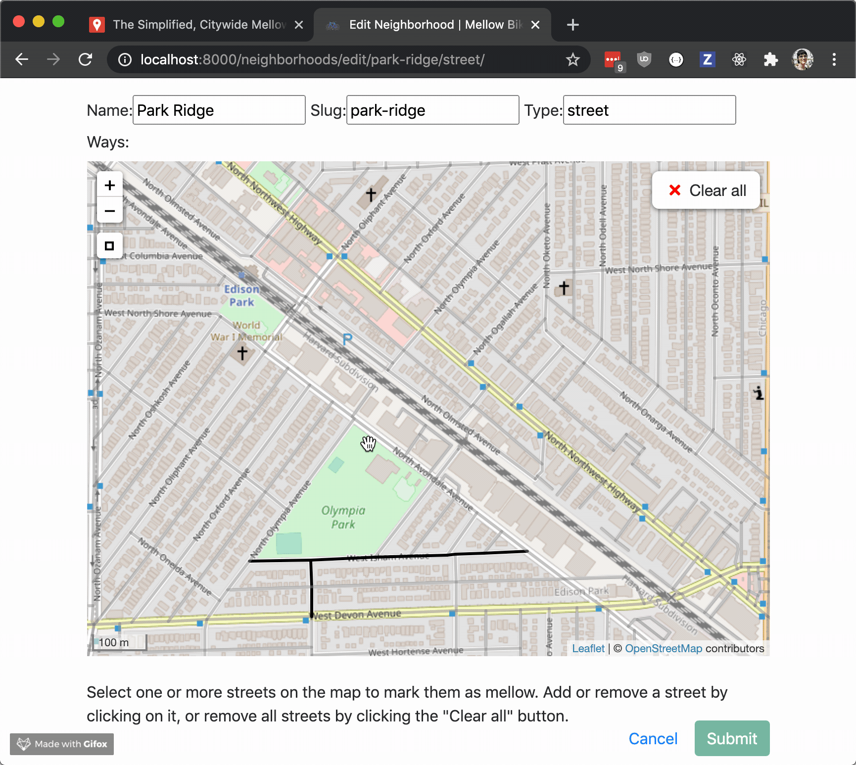
The manually-tagged mellow ways work surprisingly well but they aren't transferable to other cities and they introduce a major barrier to entry. For the next version we're working on using data on street widths, speed limits, and traffic calming infrastructure to automate the task of determining which streets are mellow.
Do you think our map is missing a good route? Or do you want to bring Mellow Bike Map to your city? Get in touch with me on Twitter and I'd be glad to help.